Remote sensing and GIS (Geographic Information System) mapping are complementary technologies used to collect, analyze, and visualize spatial data from the Earth surface. Remote sensing involves capturing data from satellites, drones, or aircraft using sensors that detect various wavelengths of light and energy, providing detailed information about land use, vegetation, water bodies, and urban development.
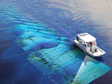
GIS mapping then integrates this data with other spatial information, allowing for the analysis, management, and presentation of geographic data in layers. Together, these technologies enable accurate environmental monitoring, urban planning, disaster management, and resource management by offering a comprehensive view of geographical areas and their changes over time. A hydrology survey is a comprehensive analysis of water-related conditions and behaviours in a specific area. It involves studying surface water, groundwater, rainfall, drainage patterns, and flood risks to assess their impact on infrastructure, land use, and the environment.
This survey provides critical information to support safe and sustainable development, particularly for projects like solar farms, wind turbines, manufacturing facilities, and other infrastructure