


A land survey is a detailed and precise measurement of a piece of land, conducted to determine its boundaries, features, and topography. Determines the exact property lines and corners of a parcel of land. Essential for real estate transactions, construction, and legal disputes. Maps the natural and man-made features of the land, such as elevations, trees, buildings, and roads, precise measurements and layout for buildings, roads, and other infrastructure. Used for planning construction projects, landscaping, and drainage systems.
A topographical survey, or topo survey, maps the natural and man-made features of a land area. It provides detailed information on elevation changes, contours, rivers, roads, and other physical attributes. Topographical surveys are essential in urban planning, engineering design, and landscape architecture, offering a thorough view of the land's current conditions for informed decision-making in development projects.
A contour survey is a specialized type of topographical survey focused on measuring and mapping elevation changes on land. It involves creating contour lines, which connect points of equal elevation, to visualize the shape and slope of the terrain. These surveys are essential for tasks like designing drainage systems, understanding water flow patterns, and ensuring proper grading in construction projects. They provide detailed information about the landscape that is crucial for planning and development.
Drone surveys, also known as aerial surveys or UAV surveys, utilize drones equipped with cameras or other sensors to capture detailed aerial imagery of a site. These surveys are highly efficient and cost-effective, making them ideal for mapping, monitoring, and assessing large areas. They are particularly advantageous for inaccessible or hazardous terrain where traditional methods may be impractical or unsafe. Industries such as agriculture, construction, and environmental monitoring benefit significantly from the accurate and up-to-date data provided by drone surveys.
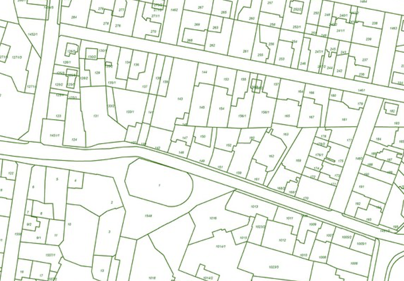
Cadastral surveys are critical for legally defining and demarcating land boundaries. They ensure accurate property lines are established, which is essential for property ownership, land registration, taxation purposes, and preventing disputes over land boundaries. Cadastral surveyors use precise measurements and documentation to create cadastral mans and records, providing clarity and legal
Engineering surveys are crucial for supporting construction projects by providing precise measurements and data for design, layout, and construction activities. They involve tasks such as establishing control points, setting out building locations, and monitoring construction progress to ensure adherence to design specifications and safety standards. These surveys play a critical role in ensuring the accuracy, efficiency, and safety of construction projects, facilitating smooth
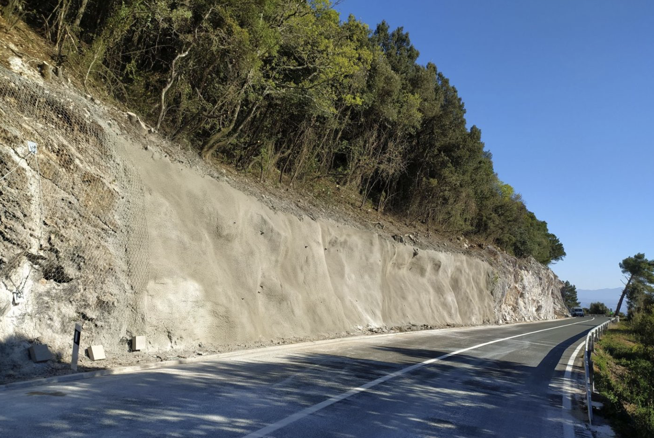
A geological survey is a comprehensive study that analyzes Earth's Draft materials, structures, and processes. It involves mapping beological features, collecting and analyzing samples, assessing geological hazards, exploring natural resources, and evaluating environmental impacts. By providing detailed insights into the Earth's composition and history, geological surveys support informed decision-making in resource management, land-use planning, and environmental protection efforts .
Avani, Wing B-609, Near Nyati Estate Road, Mohammedwadi, Pune 411060
+91 79 7208 8962
contact@geofirmconsultancy.com